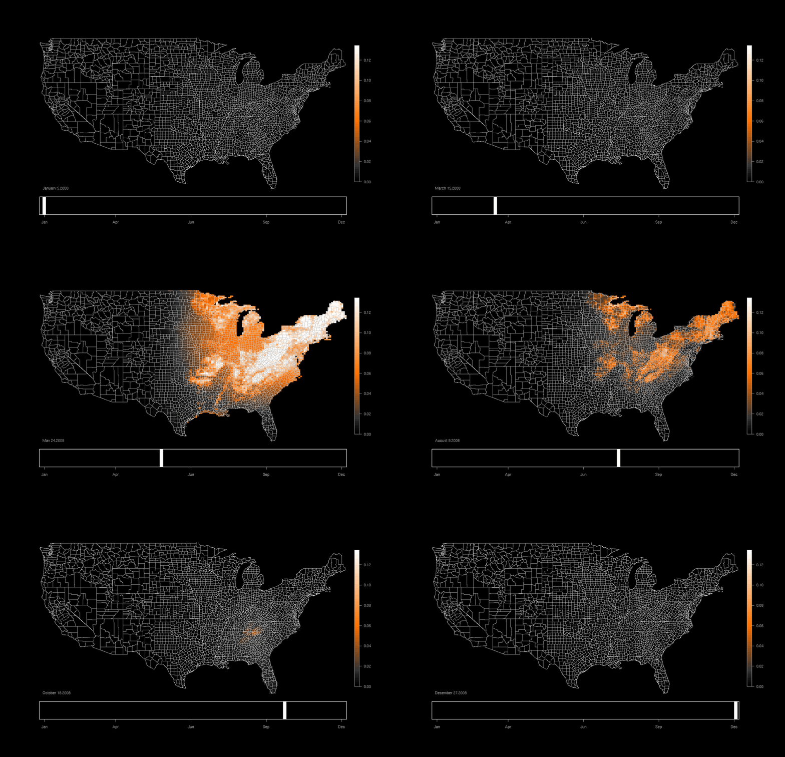
In 2002, the Cornell Lab of Ornithology launched an app called eBird that allows birdwatchers to record the birds they see. With the time, location, and bird species information, they can create these beautiful maps to understand the migratory patterns of birds across the country.
I want to do the same thing, but with environmental quality metrics and human biometrics instead of birds. Maybe birds one day, too.
These metrics are usually collected manually, either at an early site visit, or as a post-occupancy evaluation of a built project. It usually involves printing a gridded plan of a building and walking through with a daylight meter, thermometer, or anemometer and taking readings every few feet while marking it on a clipboard. This is cumbersome and it takes a long time to map a large space.
The solution is to log the data coming from the measurement device and simultaneously track the time and location of the measurement. The fun begins after a large amount of data has been collected, and can then be interpolated and mapped onto a plan of the building or neighborhood.
Step 1: Pick a device that measures something. This might be something traditional like temperature, humidity, daylight, wind speed, wind direction, or Carbon Dioxide. In the last few years, collecting biometric data has become a lot more ubiquitous and affordable. Several fitness trackers have heart rate monitors, mobile phones have accelerometers, and EEG (electroencephalography) devices that measure neural activity on the scalp have become relatively affordable for amateur researchers.
Step 2: Find a localization method that works. The world of IPS (Indoor Positioning Systems) is catching up to the world of GPS. Some systems use beacons with WiFi or Bluetooth signals to triangulate a position, others use cameras or LIDAR (like radar, but with lasers) to map the space around them and then determine the device's position in that space. This is called SLAM or Simultaneous Localization and Mapping. It's most commonly used in autonomous vehicles or by robots/drones mapping a space as they move through it. IPS is hard, so if that falls through, the back up options are to us GPS (easy to do, but not as accurate as I would like for indoor spaces. Even the most precise GPS has a margin of error of about 20 meters), to use a stationary array of devices to collect data over time, or to input the position manually, either in survey format or by quickly mark the position on the plan as you go.
Step 3: Mix and match any metrics with any mapping technique and sync them both to a universal time stamp.
Step 4: Go to town. Quickly and conveniently wander through spaces, collecting metrics and biometrics as you go. The more data, the better.
Step 5: Take the data, X, Y, Z, and time coordinates and map them, interpolating to fill in the blanks as necessary. I'll probably do this in Grasshopper.
Step 6: The hard part is asking the right questions and producing insightful results. If all else fails, the images should at least look pretty cool.


